Drone Orthomosaic Mapping in Lubbock, TX: Precision, Efficiency, and Insight
Drone technology has advanced rapidly in recent years, and one of the most powerful innovations is orthomosaic photogrammetry—a process that transforms drone imagery into detailed, georeferenced aerial maps. At South Plains Aerial Imaging, we deliver drone orthomosaic mapping in Lubbock, the Texas Panhandle, and the Permian Basin, giving businesses the tools they need to make smarter, data-driven decisions.
What Is Orthomosaic Drone Mapping?
Orthomosaic mapping uses high-resolution drone photography combined with GPS data and advanced software to create seamless, distortion-free maps tied to real-world geographic coordinates.
The process includes:
-
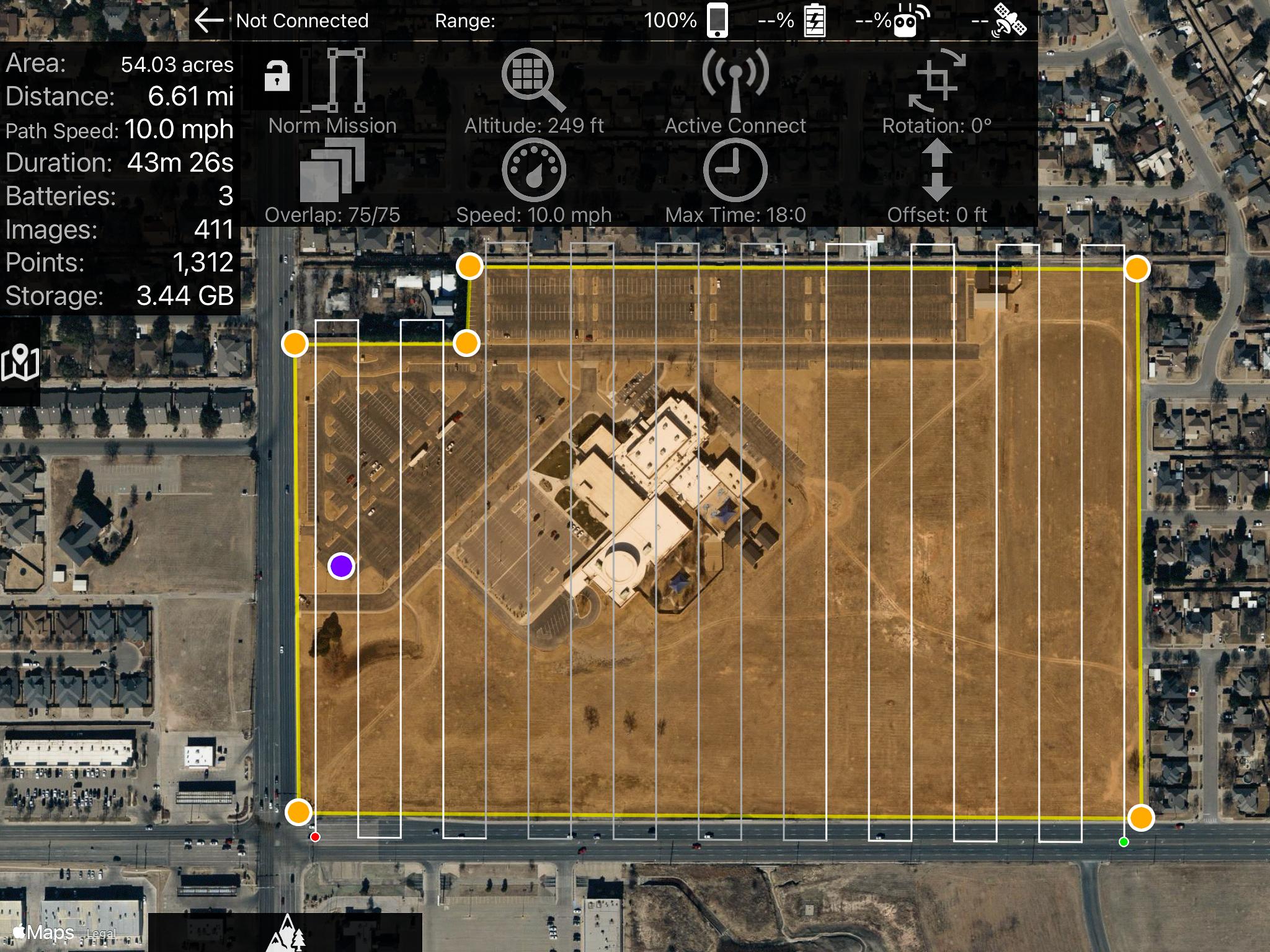
Flight Planning – Automated grid flight paths ensure full coverage of the target area.
-
Image Capture – High-resolution, geo-tagged drone images are collected.
-
Processing & Stitching – Specialized software merges images into a single, distortion-free map.
-
Georeferencing – The orthomosaic is aligned with exact coordinates for accurate analysis.
The result: precise, measurable maps that outperform traditional survey methods in both efficiency and cost.
Industry Applications of Orthomosaic Mapping
1. Agriculture
-
Monitor crop health and growth trends.
-
Detect disease and optimize irrigation.
-
Increase yields while reducing waste.
2. Construction & Infrastructure
-
Generate 3D models, topographic maps, and site plans.
-
Track progress and compare against project timelines.
-
Improve resource allocation and reduce costly errors.
3. Environmental Monitoring
-
Conduct habitat assessments and biodiversity studies.
-
Support conservation and disaster response with rapid mapping.
-
Monitor land use, erosion, and deforestation.
4. Urban Planning
-
Facilitate smarter zoning and infrastructure design.
-
Manage traffic and utilities more effectively.
-
Support sustainable city development with accurate spatial data.
5. Mining & Resource Management
-
Map terrain for exploration and extraction planning.
-
Estimate resources with high-resolution survey data.
-
Monitor environmental impact and land rehabilitation efforts.
Why Orthomosaic Drone Mapping Matters
Orthomosaic mapping provides actionable insights across industries—offering a balance of speed, safety, and precision that traditional ground surveys can’t match.
At South Plains Aerial Imaging, we combine FAA-certified drone operations with cutting-edge mapping technology to deliver reliable, accurate results that drive smarter decision-making.
Related Blogs for Further Reading
How Drones are Revolutionizing Construction: Safety, Efficiency, and Precision
📞 Schedule Your Drone Mapping Service in Lubbock, TX
From construction to agriculture, mining to environmental monitoring, drone orthomosaic mapping delivers the clarity you need to make informed decisions.
Contact South Plains Aerial Imaging today to book your aerial mapping service in Lubbock, TX, and unlock the power of precision from above.
📍 Serving Lubbock, the Texas Panhandle, and the Permian Basin.
📞 Phone: 806-502-4365
🌐 Website: www.spairimaging.com
📧 Email: info@spairimaging.com

