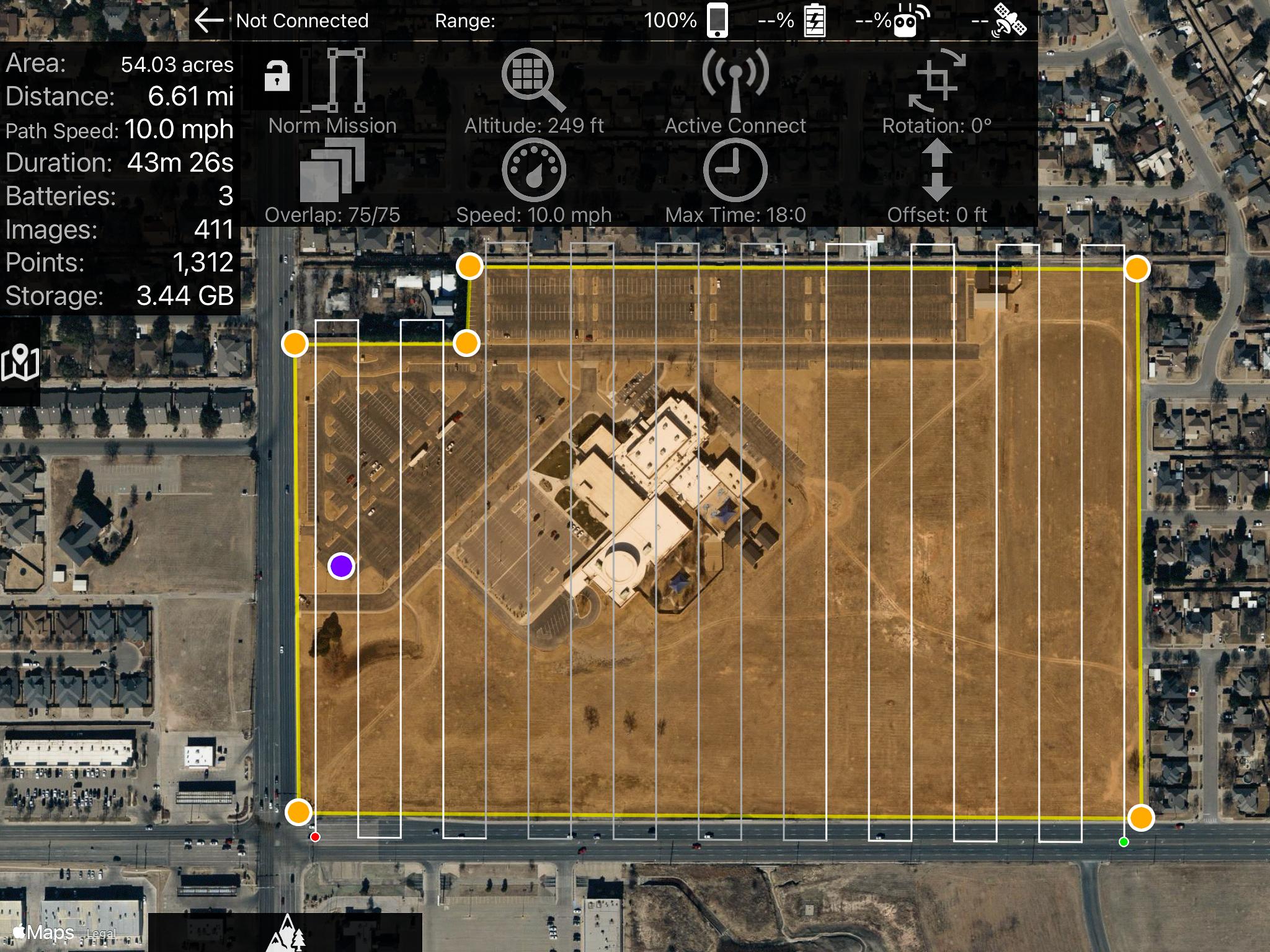
In recent years, advancements in unmanned aircraft technology have paved the way for innovative solutions across various industries. High resolution aerial mapping, (orthomosaic photogrammetry), powered by drones, has emerged as a game-changer, offering an unprecedented level of information and detail to any job site. This technology combines the precision of photogrammetry with the flexibility of unmanned aerial vehicles (UAVs), unlocking a wealth of benefits for industries ranging from agriculture to construction and environmental monitoring.
Understanding Aerial Orthomosaic Photogrammetry:
The Basics:
Aerial orthomosaic photogrammetry involves capturing high-resolution images of a specific geographic area, utilizing drones equipped with advanced cameras. These images are then processed to create orthomosaic maps, which are detailed, georeferenced, and distortion-free representations of the terrain.
How It Works:
- Flight Planning: Operators plan the drone’s flight path to ensure comprehensive coverage of the target area. The aircraft flies an automated grid pattern, at a preassigned altitude and takes images at a preprogrammed interval.
- Data Capture: The drone captures high-resolution images and terrain data using its onboard camera during the flight. The aircrafts GPS and onboard flight computer, geo-tags each image, so its precise location is known and georeferenced. The interval in which images are taken creates a overlap from one frame to the next, creating tie points for data processing.
- Image Processing: Specialized software takes the data obtained from the drones GPS and onboard flight computer and stitches these images together, utilizing the georeferenced tie points captured in each image. The software corrects distortions and alignment to create a seamless, high-precision orthomosaic map.
- Georeferencing: The resulting map is highly accurate and georeferenced, meaning it is tied to specific geographic coordinates, enabling accurate measurements and analysis for real world applications.
Benefits Across Industries:
1. Agriculture:
Aerial mapping aids farmers in crop monitoring, disease detection, and yield prediction. By providing detailed insights into plant health and field conditions, farmers can make informed decisions to optimize crop management.
2. Construction and Infrastructure:
In the construction industry, aerial orthomosaic photogrammetry enhances project planning, monitoring, and management. Accurate mapping facilitates site analysis, progress tracking, and resource allocation, reducing costs and improving efficiency.
3. Environmental Monitoring:
Environmental agencies leverage drone mapping for habitat assessment, biodiversity monitoring, and disaster response. Rapid and detailed mapping allows for timely decision-making in conservation efforts and emergency situations.
4. Urban Planning:
City planners benefit from detailed aerial maps for zoning, infrastructure development, and traffic management. The technology assists in designing smart cities by providing accurate spatial data for informed decision-making.
5. Mining and Natural Resource Management:
In the mining sector, drone mapping optimizes exploration and extraction processes. Accurate topographical data aids in resource estimation, planning, and environmental impact assessment.
Final Thoughts:
Aerial orthomosaic photogrammetry by drones is transforming the way industries approach mapping and surveying. From optimizing agricultural practices to streamlining construction projects, the applications are diverse and impactful. As technology continues to evolve, the integration of drones and photogrammetry is set to redefine spatial data acquisition and analysis, opening new possibilities for innovation and efficiency across various sectors.

