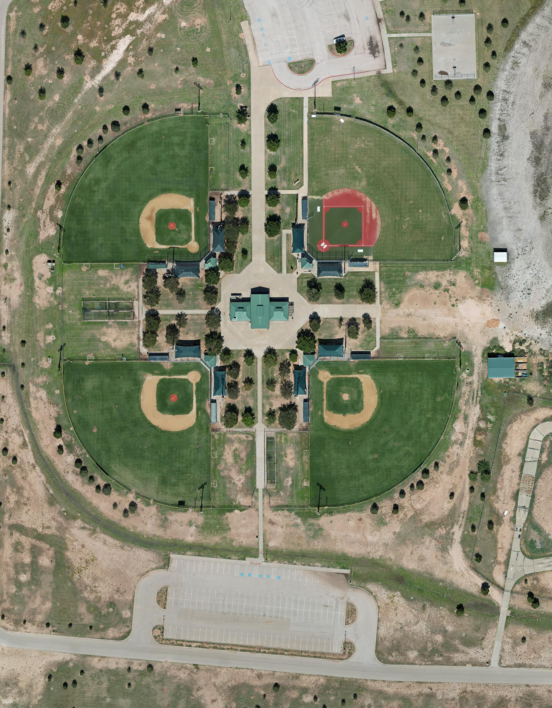
Orthomosaic Drone Mapping in Lubbock: Practical Applications for Businesses, Communities, and Individuals
High-resolution aerial orthomosaic maps are transforming how we plan, document, and interact with the world around us. Unlike survey-grade tools that require pinpoint accuracy, orthomosaic drone mapping focuses on visual clarity and spatial awareness—making it a powerful solution for businesses, municipalities, and private landowners across Lubbock, the Texas Panhandle, and West Texas.
At South Plains Aerial Imaging, we specialize in creating detailed aerial maps that provide insights for property management, event planning, storm documentation, and more.
Land Use and Property Management
Orthomosaic drone maps help visualize and manage property features:
-
Landscaping Design – Plan layouts for parks, gardens, and yards.
-
Fencing Layouts – Map boundaries and divisions.
-
Property Inspections – Document trees, structures, and roads.
-
Recreational Use – Identify trails, blinds, and wildlife habitats.
👉 Related read: Precision from Above – How Drone Orthomosaic Mapping Transforms Industries
Community & Event Planning
Cities, towns, and event organizers benefit from clear aerial overviews:
-
Festival Layouts – Plan vendor booths, stages, and parking zones.
-
Sports Facilities – Assess athletic fields for upgrades.
-
Community Gardens – Monitor and manage shared spaces.
Tourism & Recreation
Boost tourism and enhance recreational areas with drone maps:
-
Campsite Planning – Optimize layouts and locate amenities.
-
Trail Mapping – Document ATV, hiking, and biking trails.
-
Scenic Marketing – Provide aerial visuals for brochures and guides.
Marketing & Media Production
Eye-catching aerial imagery supports digital storytelling:
-
Real Estate Tours – Showcase properties from the sky.
-
Content Creation – Provide unique imagery for blogs and videos.
-
Event Promotion – Highlight outdoor venues in advertising campaigns.
Insurance & Claims
High-resolution maps simplify claims processing:
-
Roof Damage Assessments – Capture hail or storm damage.
-
Storm Surveys – Document neighborhoods after disasters.
-
Hazard Identification – Identify unsafe terrain or structures.
Construction & Maintenance
Contractors and facility managers can rely on drone mapping for efficiency:
-
Progress Monitoring – Track construction visually.
-
Temporary Structures – Plan scaffolding, tents, or staging.
-
Parking Lot Assessments – Identify cracks, drainage issues, and wear.
Disaster Preparedness & Relief
Drone maps aid in safety planning and emergency response:
-
Evacuation Routes – Identify safe pathways.
-
Shelter Planning – Locate suitable areas for temporary housing.
-
Storm Visualization – Show floodplains and tornado impact zones.
Recreational & DIY Projects
Drone mapping isn’t just for professionals:
-
Backyard Landscaping – Plan outdoor projects.
-
Hiking Maps – Document personal trails.
-
Creative Projects – Use aerial imagery for hobbies and art.
Local Government & Industry Applications
Cities and industries across West Texas use orthomosaic mapping for infrastructure planning:
-
Roadway Assessments – Document potholes and surface wear.
-
Tree Inventories – Support forestry and urban green projects.
-
Billboard Planning – Ensure visibility for advertisements.
-
Solar Site Planning – Locate rooftops or fields for panels.
Cultural & Artistic Uses
Orthomosaic maps also inspire creativity:
-
Art Installations – Plan outdoor exhibits.
-
Photography Projects – Capture unique aerial perspectives.
-
Historic Preservation – Digitally record historic sites.
Why Choose Orthomosaic Mapping in Lubbock, TX?
While some industries need ultra-precise RTK mapping, many real-world applications simply need clear, efficient, and practical visual data. Orthomosaic drone mapping delivers exactly that—without unnecessary complexity.
At South Plains Aerial Imaging, we provide professional mapping services across Lubbock, the Texas Panhandle, and West Texas. Whether you’re documenting storm damage, planning an event, or overseeing a property, our maps give you the insights you need.
Ready to See Your World from Above?
📞 Contact South Plains Aerial Imaging today to discuss your project and learn how our orthomosaic drone mapping services can deliver clarity, efficiency, and value.

