by Jonathan Lindley | May 30, 2026 | Drone Services, Local Insights
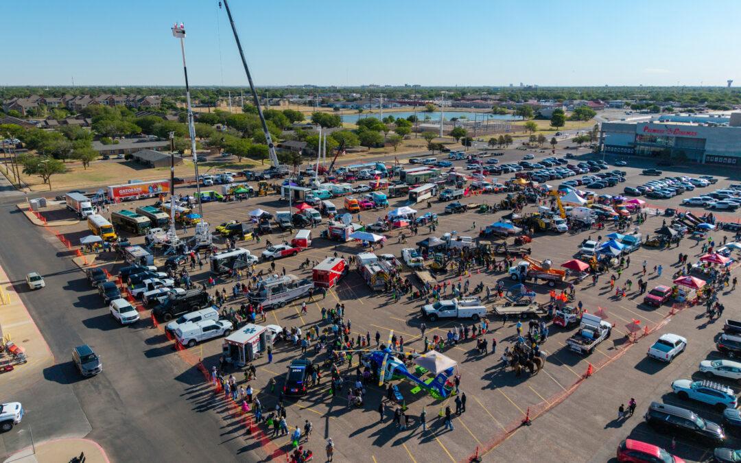
Community events are the heartbeat of West Texas. From hometown festivals and charity fundraisers to parades, sporting events, agricultural celebrations, and civic gatherings, these occasions bring neighbors together and strengthen local communities. Through...

by Jonathan Lindley | May 7, 2026 | Industry Insights, Local Insights
The DJI drone services industry has become a critical part of modern business operations across the United States. From aerial photography and aerial videography to infrastructure inspections, agriculture, surveying, and public safety, DJI aircraft have transformed...
by Jonathan Lindley | Mar 31, 2026 | Uncategorized
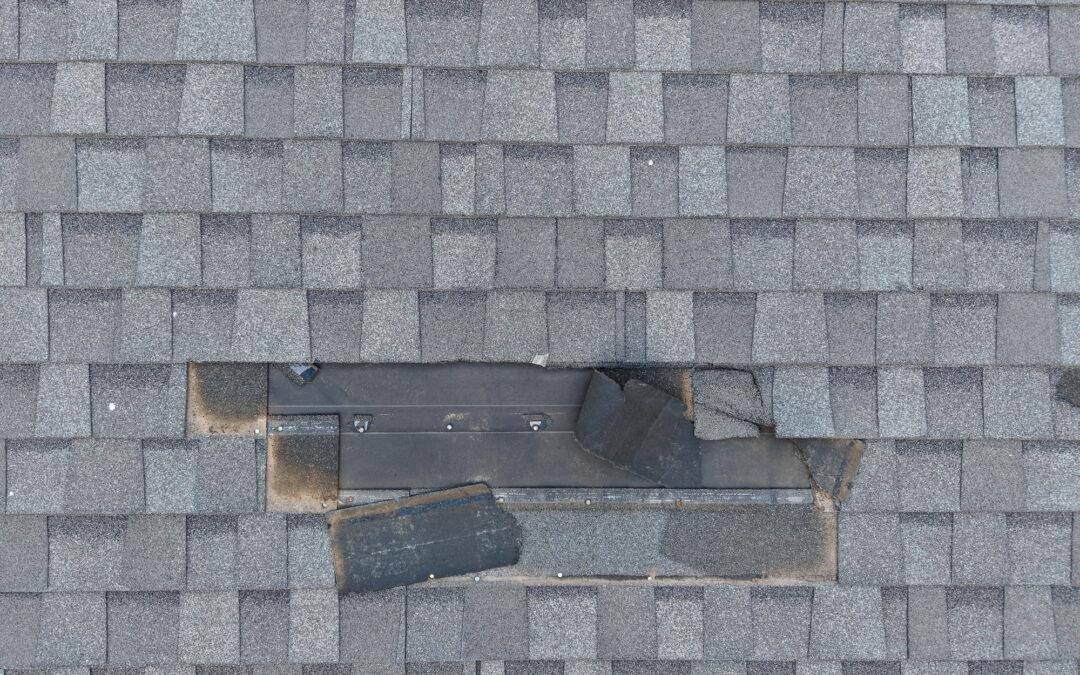
Missing Shingles Roof Damage: What It Means for Your Roof’s Integrity Missing Shingles Roof Damage is one of the most common—and most underestimated—roofing problems faced by homeowners and property managers. While a single missing shingle may not seem like a major...
by Jonathan Lindley | Mar 11, 2026 | Uncategorized
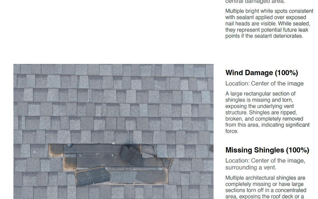
When it comes to protecting your property, AI Aerial Roof Integrity Reports are rapidly becoming one of the most valuable tools available to homeowners, property managers, and commercial building owners. By combining high-resolution drone imagery with artificial...
by Jonathan Lindley | Feb 27, 2026 | Uncategorized
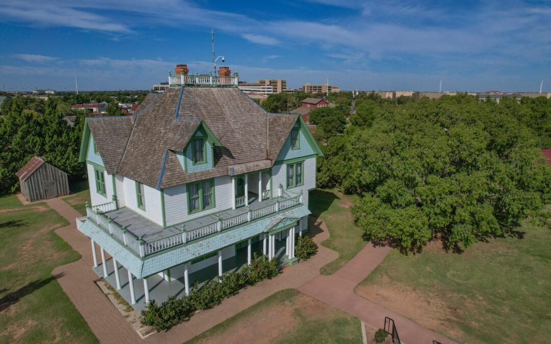
Drone Inspection for Historic Buildings: Preserving the Past Without Risk Historic landmarks connect us to our shared heritage, but maintaining these structures presents unique challenges. Traditional inspection methods often involve scaffolding, lifts, or direct...
