
Services
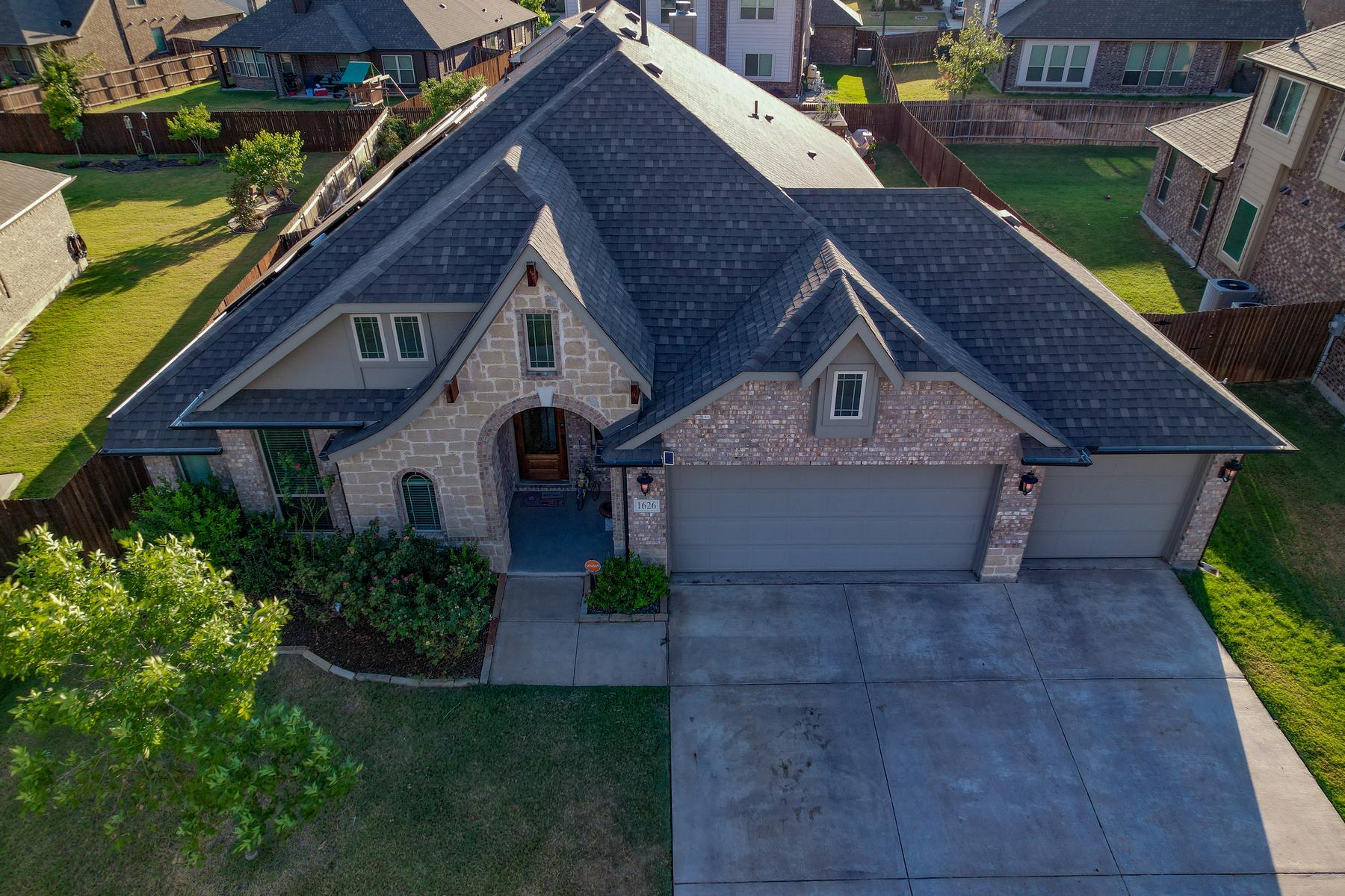
Aerial Photography
Capture breathtaking aerial images with South Plains Aerial Imaging, your trusted drone photography expert serving Lubbock, the South Plains, West Texas, and the Texas Panhandle. Our FAA Part 107 certified pilots use state-of-the-art drones to deliver high-resolution aerial perspectives that traditional photography simply can’t achieve.
Our drone photography services are perfect for real estate listings, construction site documentation, marketing campaigns, special events, and professional inspections. Each aerial image showcases scale, context, and detail from angles that ground-level photography cannot duplicate.
Beyond stunning visuals, aerial imagery saves time and adds powerful impact to your projects. Whether you’re highlighting a property, tracking construction progress, or creating compelling content for your brand, South Plains Aerial Imaging provides the clarity and detail you need.
Book your professional aerial photography session today with South Plains Aerial Imaging and experience your property, project, or event from a whole new perspective across Lubbock and West Texas.
Aerial Videography
Take your storytelling to new heights with South Plains Aerial Imaging, your trusted provider of professional drone videography in Lubbock, West Texas, and the Texas Panhandle. Our FAA Part 107 certified pilots capture cinematic-quality footage with smooth, dynamic drone shots from unique perspectives.
Our aerial videography services are perfect for real estate listings, marketing campaigns, commercials, events, construction progression, inspections, and promotional content. Each video highlights scale, emotion, and detail in a way that keeps viewers engaged.
In addition, drone videography provides businesses with a powerful tool to showcase properties, tell stories, ensure compliance and promote brands. Every frame is carefully captured to strengthen your marketing efforts and create a lasting impact.
Schedule your professional drone videography session today with South Plains Aerial Imaging. Showcase your property, project, or event from a breathtaking perspective across Lubbock and West Texas.
Aerial Inspections
South Plains Aerial Imaging provides professional drone inspections in Lubbock, West Texas, and throughout the Texas Panhandle. Our FAA Part 107 certified pilots perform aerial inspections for roofs, building facades, construction sites, and other critical infrastructure, delivering precise, actionable data for your projects.
By leveraging advanced drone technology, we enhance safety, reduce risk, and complete essential inspections efficiently, making them ideal for real estate evaluations, insurance assessments, construction monitoring, and commercial property inspections.
Schedule your professional drone inspection today with South Plains Aerial Imaging and ensure your property, construction site, or commercial project is safe, compliant, and thoroughly documented across Lubbock and West Texas.
Aerial Mapping
South Plains Aerial Imaging provides professional high-resolution aerial mapping services in Lubbock, West Texas, and throughout the Texas Panhandle. Our FAA Part 107 certified pilots capture precise orthomosaic maps and aerial imagery, giving businesses, municipalities, and individuals a powerful tool for data collection, analysis, and informed decision-making.
From construction site monitoring, to real estate planning and infrastructure evaluation, our aerial mapping services help you visualize, measure, and interact with your project like never before.
Schedule your professional drone mapping session today with South Plains Aerial Imaging and gain high-resolution aerial maps and actionable insights for your project across Lubbock and West Texas.